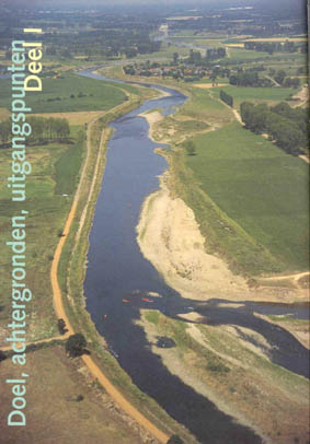
| limburg
|
|
Key issues for water management
in the Netherlands include the integration of the
water system’s functions for ecology and society, their
sustainable development, a river basin approach,
and increasing the natural ‘resilience’ of
the water systems. As a result of the large floods in 1993
and 1995, in 1997 a coordinating project for the Meuse was
initiated, ‘De Maaswerken’. This integrated project
aims on the one hand to reduce the chance of flooding, and
on the other hand to develop large-scale nature areas and
stimulate economic development by furthering water transport.
To this end, the Meuse will be deepened and broadened over
a length of about 200 km. The aim of the FIRMA project is
to provide an integrated framework for decision making in
inland water management in the Meuse basin of the Province
of Limburg within the context of the project ‘De Maaswerken’.
This will involve:
- Identification of consistent
integrated scenarios of socio-economic and environmental
changes in the Limburg part of the Meuse basin
- Analysis of the hydrological
changes that may result from different scenarios and
management strategies and the consequences for the user
functions of the water system
- Analysis and simulation
of consumer behaviour and its impact on future water
demand in the Limburg part of the Meuse basin
- Analysis and simulation
of the rule governed behaviour of water managers and
its consequence for future water supply in the Limburg
part of the Meuse basin
- Analysis and simulation
of the dynamic interplay among various stakeholders
such as water managers, landscape planners, shipping
transport experts, ecologists, jurists, archaeologists,
citizens, and NGO-representatives to develop and implement
an integrated masterplan for the Meus
3
main issues
- Flood
prevention
- Improvement
of the navigation route
- Development
and recovery of (aquatic) nature in and alongside the
river
|
|
|
| *
Meuse and Maas are synonymous names for the same river!
For
water management in Limburg in general several interrelated issues
can be specified under the general policy for natural and resilient
water systems. These are:
- Sustainable
water supply: partly shift the water supply from groundwater to
surface water to surface water resources
- Increasing
infiltration, conservation and retention of water for both natural,
agricultural and developed areas
- Recovery
of aquatic nature and drought prevention
- Sustainable
water management in developed areas Decrease of pollution from
diffuse sources like agriculture, navigation and traffic

the
maaswerken project
In
December 1993 and January 1995 the Meuse unexpectedly flooded in
the region of Limburg, affecting some 10 000 people and causing
several hundred millions guilders of damage. As a direct result
of these floods the national government and the province of Limburg
in collaboration initiated the co-ordinating project "De Maaswerken".
This integrated project aims on the one hand to reduce the chance
of flooding, and on the other hand to develop natural areas[4] and
stimulate economic development by furthering water transport. To
this end, the Meuse will be deepened and broadened over a length
of 200 km. The extracted gravel will be exploited to co-finance
the project. Additional measures include the (re-) construction
of embankments, sluices and so-called "clay shields" that will drive
up groundwater on the riverbanks.
The
most important governmental institutions related to the Maaswerken
are the project organisation "De Maaswerken", the province of Limburg
and the national Ministries of Agriculture, Nature and Fisheries
(LNV), and Transport and Public Works (V&W). Especially the organisation
Rijkswaterstaat, the organ of the Ministry of V&W that is responsible
for the execution of public works related to water, plays an important
role. The organisation "De Maaswerken" was set up in 1997 taking
its employees partly from Rijkswaterstaat, the Province of Limburg,
the Ministry of LNV and many other local, provincial and national
governmental organisations. The final responsibility for the project
lies with the minister of V&W.
stakeholders
All
relevant stakeholders are displayed in Table 1: Maaswerken stakeholders
on distinct scale levels |
| stakeholders |
scaling
level |
| |
Local |
Regional |
National |
International |
| Ministry
of Agriculture, Nature and Fisheries |
. |
. |
. |
. |
| Ministry
of Traffic and Public Works |
. |
. |
. |
. |
| Foreign
governments |
. |
. |
. |
. |
| Benelux
parliament |
. |
. |
. |
. |
| Province
of Limburg |
. |
. |
. |
. |
| Municipalities
|
. |
. |
. |
. |
| Rijkswaterstaat
|
. |
. |
. |
. |
| Waterschappen,
Zuiveringsschap |
. |
. |
. |
. |
| Citizens
|
. |
. |
. |
. |
| Farmers
|
. |
. |
. |
. |
| Water
company |
. |
. |
. |
. |
| International
users and polluters |
. |
. |
. |
. |
| chemical,
paper industry |
. |
. |
. |
. |
| gravel
extraction industry |
. |
. |
. |
. |
| navigation
sector |
. |
. |
. |
. |
| NGOÍs:
Milieudefensie, Natuur-monumenten, Greenpeace |
. |
. |
. |
|
|
| environment
characteristics
international
catchment
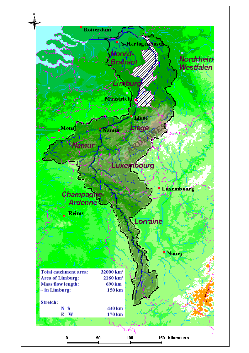
The
Meuse catchment, shown in figures 1and 2, lies mainly in France,
Belgium, Germany and the Netherlands. The Dutch province of Limburg
is located entirely within the catchment. The Meuse is a rain fed
river. Average rainfall in the catchment is the highest in the Ardennen
region with around 1200 mm of rain annually. Through steep and rock
based side rivers this water is transported quickly to the Meuse
and reaches the Dutch border in about half a day.
Figure 1: The
Meuse Catchment |
 |
|
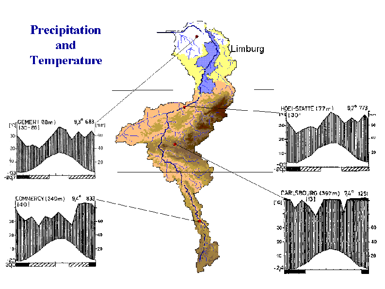
Figure
2: Examples of rainfall and temperature data within the Meuse
catchment
|
|
|
the
limburg region
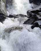
The
Meuse in Limburg is a river without dikes. The stretch of land next
to the river has therefore a relatively high risk of being flooded,
although the resulting damage may be relatively low (material damage,
no loss of lives). On the basis of morphological characteristics
the Meuse can be subdivided into four parts): Grensmaas, Plassenmaas,
Peelhorst and Venloslenk, the latter three being part of the Zandmaas.
The Grensmaas is a gravel-based river flowing freely without the
intervention of dams and sluices. This makes the river potentially
valuable for nature development. The Grensmaas drains water from
the regional groundwater system (effluent river). The Plassenmaas
takes its name from the large gravel pits that were created through
gravel extraction during the past decades. Yet, the gravel winning
has ended this region is valuable for industry, shipping and recreation.
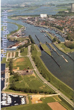
After Neer the Meuse enters the Dutch delta, where the base of the
riverbed consists mainly of sand. Dams and sluices are used to control
water levels in order to make the river navigable. Here, river water
recharges the groundwater reservoir (influent river). In Peelhorst
the river valley is quite narrow; further downstream in Venloslenk
the valley widens up. |
|
Zandmass
Grensmaas
|
|
|
trends
in the environment
floods
and water-related damage |
| Year |
Discharge
(m3/s|) |
At |
Waterlevel
(mNAP) |
At |
Damage |
Remarks |
| Dec
1643 |
- |
- |
~48.7 |
Maastricht |
- |
Highest
water level ever measured |
| Dec
1880 |
- |
- |
20.77 |
Roermond |
- |
- |
| Mar
1910 |
- |
- |
~46.1 |
Maastricht |
- |
- |
| Jan
1920 |
~2250 |
Borgharen |
20.6 |
Roermond |
- |
Similar
discharges or larger happened ~ 10 times this century |
| Jan
1926 |
~3100 |
Borgharen |
42.92 |
Maastricht |
millions
of guilders of damage, 14.000 refugees. |
Probably
largest flood disaster. Breakthrough of dikes and inundation
of "Land van Maas en Waal". |
| Jul
1980 |
~
2200 |
Borgharen
|
- |
- |
- |
In
summer !! |
| 1984
|
~
2600 |
Maastricht
|
- |
- |
- |
High water that caused the Belgians to build / raise their dikes.
The Netherlands made plans, but they were never executed, probably
related to the finishing of the Deltawerken project. |
| Dec
1993 |
3120
|
Borgharen
|
45.8
|
Borgharen
|
245
million guilders |
- |
| Jan
1995 |
~
3100 |
Borgharen
|
45.71
|
Borgharen
|
210.000
evacuated, 35 million guilders private damage. |
Threat
of inundation Betuwe, land van Maas en Waal. With nine days
in a row, this was longest high water of the century. |
|
|
waterworks
- Centralization
of water management in 1798
- Main
water works in Limburg in the twenties
and thirties:
- 1920-1940:
Canalisation and construction of weirs and sluices
-
1935: Julianakanaal
- 1939:
Albertkanaal
- Extraction
of gravel and sand started around ?
rainfall
Rainfall
data is available from 1882 on. A clear indication of the
Greenhouse effect cannot be seen.
land
use
- From
1834 to 1992 increase of 8% of forest area in the Ardennen
- Indication
of reduced retention in Zuid-Limburg due to different farming
techniques and crops (leading to more pronounced discharge peak
flows in streams)
-
Increased urbanization in the Meuse and Sambre valleys (between
Charleroi and Liege), especially after 1980. Urbanization should
not have a large effect on extreme flood events, since with extreme
rainfall the point of complete saturation of the ground is reached
quickly anyway (However, this is in discussion).
major
changes and uncertainties that are expected
to happen during the next decades in the environment and in the
socio-economic boundary conditions
- Morphological
changes in the riverbed (deepening and widening)
- Change
in water demand
-
water withdrawal (lifestyle, technological development, economic
development, etc.)
- in-stream
use (transport, nature)
- Change
in water supply - shift from groundwater to surface water
- Land
use change: from agricultural land to natural terrain from
agricultural land to housing
- Climate
change
- Institutional
changes within Europe
Many
of these changes lead to: -> Change in runoff and water level
Importantly,
there might be changing perspectives in Europe, The Netherlands
and Limburg. This may result in a changing appreciation of values
like safety, nature and prosperity.
major
questions that should be addressed with the model at the current
stage of knowledge about the region and stakeholder interests
- What
measures within the Maaswerken project will lead to improvements
for safety, shipping and nature (win win win) under changing socio-economic
and physical boundary conditions?
- What
are the advantages of ABM within an integrated framework, and
how can we combine ABM with IA?
organisation
of participatory process with reference to problem specification
-
Identifying relevant stakeholders in relation to the three major
questions mentioned at 1).
- Informing
the stakeholders about the project and the participatory process.
- Characterizing
goals, perception and potential impacts of each stakeholder separately.
- Organize
sessions with the group of stakeholders to study the interaction
patterns.
- Final
session presenting the results. Note: Due to the complexity of
our regional situation there will be a broad range of relevant
stakeholders.
references
1.
Trajectnota/MER Zandmaas/Maasroute, Hoofdnota.
2.
MER Grensmaas, Hoofdrapport A.
3. Visie Maasdal Zandmaas/Maasroute.
4.
Onderzoek watersnood Maas, Hoofdrapport "De Maas Meester"
5.
Centraal Bureau voor de Statistiek (CBS), statline http://statline.cbs.nl/statweb/indexned.stm
6.
Met de stroom mee, Streekplan Grensmaas
7. In de ban van het water, de Volkskrant
8.
Watersnood in Limburg, van 1900 tot nu, Pieter Trompetter.
9.
Ruimte voor water, Thema bijdrage voor het POL
10.
Walter, H. and Helmut Lieth (1960) Klimadiagramm-Weltatlas
|
|